Wednesday, June 29, 2016

Lake Barkley, KY

June 27, 2016

We said our goodbyes last night and left Beaver Dam SP this morning for our drive to Lake Barkley, KY.  We didn't have an actual destination picked out since we didn't know how far we wanted to drive.  As it turned out, it was a good thing that we didn't plan on driving further since we ran into a little traffic jam.

We took the back roads to our connection with I-64 and then on to I-55 South.  Back roads take you through the small towns and we always enjoy seeing new places.  Our GPS kept trying to route us on the interstates and I just ignored them for the most part.

All went well until we were near Benton, IL on I-55 when traffic came to an abrupt standstill.  Usually it's a sign of roadwork but there weren't any signs out so we didn't know what was happening.  We crept along with numerous starts and stops for about an hour and only went a mile or so.  Gerry got on the Waze app to see what was causing the backup.  Accident ahead and numerous police alongside of the road was the answer.

We didn't have much choice to avoid the area since there weren't any exits around,  We finally hear the right lane was closed so I managed to switch over to the left lane.  Finally, we came upon the scene below


 The right lane had a street sweeper in it along with a truck loaded with debris from the tractor trailer truck just down the road a little bit.  It seems a truck driver ran into a bridge and demolished the trailer and damaged the tractor.  There was a small fire but it was out when we drove by.  The accident occurred at 8:15am and we passed it around 3:00pm.  The driver was shaken up but not injured badly.


 It took us about 2 hours to get past the accident and then we made great time.  Gerry was on the phone and started checking for a spot to stop for the night.  We were near Kentucky Lake and managed to get a nice spot on Lake Barkley.

Ohio River bridge
 Gerry managed to snap a photo of some barges heading south over the Ohio River.


 The campground was about 6 miles off of I-24 on narrow roads that kept getting more narrow as we approached the entrance to the campground.  The camp host at the Eureka campground held our pull through site for an hour or so until we arrived. 


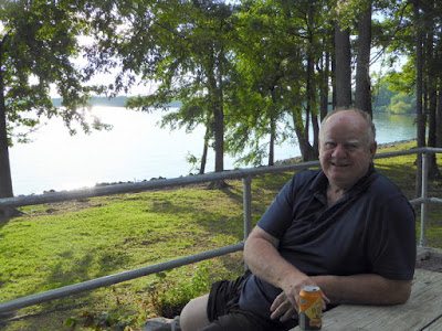
 Our site was right on the lake and had a nice picnic table with a nice view.  The campers on either side of us were catching fish and having a great time.  I wish they had a National fishing license so travelers such as us could fish in the great spots.  Buying a license in each state runs into a large cash outlay if you have to buy an out of state license in each place.


We were surprised to see a long barge on the other side of the lake since we didn't know about the locks there.  The Cumberland River forms the lake and there was a lot of barge traffic in the area. 


 The trees on the other side were part of the "Land Between The Lakes" part of Kentucky.  We camped on the far side when we took our grand daughter Stephanie on her trip with us when she was 12.  


We sat outside and had a couple adult beverages and enjoyed the beautiful sunset.  


That was our day, how was yours?

Catching Up On Illinois Visit

June 25, 2016

We had considered staying a few more days in Illinois but the camp host came by and said we had to leave on Monday.  Well, what he actually said was that they were going to turn off the water to the park.  It seems that the State Of Illinois hasn't paid the water bill since last December and the local water company decided to cut off the supply.  They also hadn't paid for the diesel fuel, repairs, and a host of other bills that are overdue.

The park isn't alone in this problem since rest areas have been closed for nonpayment of water, electric and other bills.  The Republican Governor refuses to sign the budget bill as the Democrat controlled house and senate presented to him. Illinois hasn't had a budget since 2015 and this has created many problems.  I don't presume to know what all the fighting is about but I do know Illinois is deep in debt and it sounds like the budget bill delay will push them deeper.

We had a great time visiting family and managed to see all of my brother's 7 children and their families while we were there.  They had a big party on Father's Day to honor their dad and Gerry and I attended the party.  There were his children, grandchildren and great grandchildren there and it was a madhouse.  In other words, we loved it and got to talk to everyone.


A caved in bridge made us late getting there, but we finally arrived.  It seems a truck with 25 tons tried to cross over a 5 ton bridge and it caved in.  This happened a couple years ago and the bridge hasn't been replaced and maybe won't be in the future.  Once we went an alternate route we made good time traveling the country roads.

My brother Dick was there for almost all of the party and finally the heat and long day wore everyone out and the party broke up.  I must have drank 5-6 bottles of water and still couldn't seem to drink enough.  

We had dinner with Dick and Sue numerous times during the week and tried out a number of local restaurants.  One in particular stood out since it was called The Full Throttle bar and grill.  If you know anything about motorcycles you can tie the name in with cyclists.  At one time it was a rowdy place with a pole dancer and was mostly frequented by bikers.  A few incidents caused changes to be made to the place and it is nice enough now.  My niece Sheryl and her husband joined Gerry and me, along with Dick and Sue for dinner there one evening.  Good food, company and cold beer.  Great combination.

During one of our outings I made my required journey to Jubelt's Bakery in Litchfield, IL to pick up some of their great pastries.  We bought enough for three days and would have gone again if it wasn't so far out of the way.  If you are in the area it is located between Old Rt 66 and New Rt 66 and next to the Ariston Cafe.  Try it, you will like it.

Gerry met three of her high school classmates for a looooooong lunch one day.  They had a great time bringing each other up on their happenings this past year and managed to tie up a table for almost 4 hours.  I picked Gerry up and talked to Mary Elaine for a part of this time.  

We took some drives checking out old stomping grounds, houses and taking in all the changes to the area.  It sure isn't like it used to be when we were kids.  Instead of 18 bars in Gerry's hometown, they are down to 1.  I guess the tough Illinois drinking and driving laws have had quite an effect on the area.  My hometown is down to 2 bars and even they close up early.

Gerry got her DQ fix a couple times in Gillespie and loved it, while her one trip to the DQ in nearby Carlinville wasn't up to snuff.  Their blizzards were more like milkshakes and runny.  

Monday, June 27, 2016

Barefoot Restaurant & Illinois Great River Road

June 24, 2016

We finally have a good internet connection and I'm going to fill in some things we did while we were in Illinois.  As mentioned in the previous posting we stayed at Beaver Dam State Park since all (very few) campgrounds in the area were full.  There is a large pipe-line project going through the area and the workers have taken all the campsites and most of the hotel rooms.  

Our good friends Gloria & Doug were parked at her brother's home about a mile away from us and we made plans to drive down to Hardin, IL on the Illinois River for a catfish lunch.  The Barefoot Restaurant is right on the river and doesn't look like much from the outside, but they serve a great catfish dinner for a very reasonable price.  Gerry and I had the lunch special of a large catfish sandwich and cole slaw for $6.99 and draft beer for $1.25.  (Yes, we do love catfish)   They recently went up on the beer 25 cents.  The meal was large and very good.  Gloria & Doug had the catfish fritter dinner and it was so large they couldn't finish it.   Gooood eating!


 Hardin in Calhoun County, IL is bordered by the Illinois and Mississippi rivers.  It's location made it isolated for many years until the Joe Page bridge was built making it more accessible to the rest of  Illinois.


Calhoun County is noted for it's orchards and fantastic peaches.  When I lived in Illinois I was a big fan of the softball size peaches from there.  My father used to drive there in his van and pick up 20-30 bushels of peaches and take them back to Gillespie and sell them.  That was his idea of how to spend his vacation time from his full-time job.


 Looking down on Hardin main street from the old cemetery on the hillside with a view of the Illinois River.


 Calhoun County, like Jo Daviess County in northwest Illinois, is unique in the state in that glaciers didn’t touch it and therefore has a more rugged terrain that is dissected by valleys than the generally flat terrain associated with the rest of Illinois. Calhoun County is also located at the tip of the peninsula formed by the Mississippi and Illinois Rivers and is almost completely surrounded by water. Brussels is located near the southern tip of the peninsula on a fertile ridge top with some shallow valley slopes that makes it a suitable site for farming and orchards. German immigrants first settled this small country village in 1822 that were attracted by the fertile land that had an adequate water supply and nearby forests that provided wood for construction and fuel. The lack of any railroads or bridges into Calhoun County has meant that Brussels has always been sparsely populated with a population never reaching greater than several hundred, allowing it to retain the feeling of a small but active agricultural community of the late 19th and early 20th century.


 We took the free Brussels ferry ride back across the Illinois River and enjoyed the short boat ride. 


 The Mississippi & Illinois rivers join at Grafton, IL.  The flood of 1993 damaged the town so much that 1/3 of the population left and never returned. 


 There were settlers in Grafton as early as 1812 so I'm not sure what the birthday cake shown below stands for.  It was an impressive cake though.


 Bluffs along the Great River road near Grafton, IL.  This road is flooded out often when the Mississippi river floods.  It is a beautiful drive with the bluffs on one side and the river on the other.

The area is noted for it's Bald Eagle population that nest and winter in the area. 


During the flood of 1951 the Mississippi River had risen so high that it threatened Portage des Sioux for the first time in the history of the town. In a 1957 article The St. Charles Banner-News reported: “While the streets of many riverbank communities disappeared beneath the rising waters, something important was happening in Portage des Sioux, Mo. Father Edward B. Schlattmann, pastor of St. Francis Church, called upon his parish Legion of Mary to pray to the Blessed Virgin. For the first time anywhere, Mary’s protection was sought under the appellative, “Our Lady of the rivers.” The surging current swept over the roads leading into Portage and lapsed hungrily toward the town. Isolated and frightened, Portage people watched helplessly as the water inched nearer their homes. After two weeks, when the flood finally crested, their community was mostly high and dry.”


In gratitude, the parish decided to erect a statue on the banks of the river, dedicated to “Our Lady of the Rivers.” Word of the project spread, and contributions came in from all over the United States. In October 1957, ten thousand people attended the dedication of a 25-foot fiberglass statue of Mary mounted on a 20-foot concrete pedestal that sits at the water's edge looking across the Mississippi to the bluffs above Alton, Illinois.


The annual tradition of the Blessing of the Fleet in July soon followed. Hundreds of decorated boats gather from miles around to receive a blessing from the town priest asking for Mary's intercession to protect their vessels from harm. After the blessing the boats parade up the river to the nearby town of Grafton, Illinois.


Our trip was cut short by a bad accident on the Great River road and we took a detour around the accident.  The driver of a Jeep lost control and flipped over.  It took a long time to clear the accident.  By this time we had enough of driving and headed back to our campground.  I always enjoy the drive down in that area and look forward to making the trip again.

That was our day, how was yours?

Sunday, June 26, 2016

Beaver Dam State Park, Carlinville, IL

We have been here at Beaver Dam SP for the past 8 days visiting with family and friends in the area.  The internet & phone connection has been terrible and this is the first time I could get on to update the blog.  Forget about loading any pictures, it ain't going to happen.

We plan on leaving Monday morning and heading for Kentucky, TN, VA and home to the cabin in PA.  ETA around June 30 to avoid the July 4th weekend and the madhouse it will be in campgrounds.

It's been very hot here and we've been running the a/c most of the time except for the late night when it cools off.  It is difficult to open the windows since every camper has a nice blazing campfire to sit around.  Don't they know the campfire makes it even hotter?  Oh well, we used to do the same when we camped in our popup camper back in the 60s and 70s.  Not now though.

I will write more when we get a good signal.  Keep cool out there.

Friday, June 17, 2016

US State Capitals Quiz

Just a short blog tonight with a few questions for my readers.  If you know my email address, send me the answer or just type in the answer as a comment.

Which US President created the US Interstate Highway System?

How many and what are the names of State Capitals that are not served by an interstate?

No cheating by looking at a map or googling the answer.

Have fun and good luck. 

BTW:  We are in Branson, MO and sweltering in the 98 degree weather with high humidity.  Where is the dry heat when you need it?

Tuesday, June 14, 2016

Finding Campsites in the Summer

Most full time rvers know enough to avoid trying to reserve a campsite in the summer, especially during holiday weekends.  The weekend warriors and families reserve every weekend in the summer and it's very difficult to find a site for Friday & Saturday night.  Now it's even getting difficult to find one during the week.

We are heading to Branson, MO and have a reservation for three nights at an Escapee Park and should have made it longer.  The local (and only one close) to my brother's home in Gillespie, IL doesn't have any sites available for next week or the following week.  We can get into a COE campground about an hour away but the drive back and forth each day really gets old fast.

A niece has a spot for us at her home with electric and water in Springfield, IL but that is an hour away also.  Another niece near Gillespie may be able to help with an electric hookup and we can fill our water tank.  Guess we will have to make a decision soon. 

I guess the stories about RV sales being up are really true and there are so many people out there trying to find spots in a limited number of sites.  Just a few years ago there never was a problem finding sites on a short notice.  Of course, the Florida Keys is always a difficult place to find sites.  

Our friends, Debbie and Dale, with whom we spent Memorial Day week, sent beautiful photos of their hike at Capital Reef.  Debbie said it was the most difficult hike she has ever done, what with the heat and the difficulty of the location.  If we were 20 years younger, we would have loved to hike it with them.

I guess we will spend July & August at our cabin where we are assured of a space with water & electric.  The only bad thing about that is there is so much work to be done that we leave tired out and look forward to getting back on the road.  We do look forward to the Fall season when all the little kiddies and parents are back at work and school.

We went geocaching today in the area around Heyburn Lake and managed to find 7 caches.  There were many more close by but it was quite warm and it was uncomfortable getting in and out of the a/c in the car.  None of the caches were that difficult and weren't that interesting so we called it quits early.  We are up to 1,583 found caches and moving in on 1600.  

We couldn't find a cache in Silverton, CO a couple weeks ago and told the owner that it was missing.  He placed the cache out of service and when he went to look for it the cache was gone.  Two people "signed the log" as being found after my reporting the loss and that raises questions.  Did they actually find the cache or just take credit but not actually find it? 

That was our day, how was yours?


Monday, June 13, 2016

Heyburn Lake, Oklahoma

We left Bernalillo Saturday morning with Amarillo, TX as our destination for Saturday night.   RT 550 is so busy that we had to make a right turn and then pull through a service station on the left side of the road.  It was impossible to find an opening in traffic to make a left turn out of the campground.  Busy, busy road for a Saturday morning.

We stopped at a local Valero fuel station to fill the tank on the motorhome.  It didn't take much, but I wanted to travel on the top half of the tank.  We were using the generator to run the a/c to keep it comfortable in the coach and it was using a fair amount of fuel.

It was a windy day with a 17-22 mph side wind, but the coach handled it fine.  We cruised along at a steady 65mph pace until we got within 10 miles of our stop at the Oasis RV park west of Amarillo.  Then we ran into some very heavy wind and it was difficult to control the motorhome, but thankfully I was able to slow down and pull into the campground.  I am sure glad that I didn't have that wind to contend with all day.  Because of the strong winds Gerry had troubles with the motorhome door and then the park office door as well.

Sunday morning we left Oasis RV park and drove to Heyburn Lake near Kellyville, OK.   We took the turnpike out of Oklahoma City and finally exited onto the famous US Route 66 for a few miles.  We lived near US 66 in Illinois when we were kids so it doesn't have the magic for us to drive on it.

The park attendant gave us directions to the lake and we thought she must have given us bad instructions.  The road was barely wide enough for the motor home and we crossed over the I-44 turnpike on a bridge rated at 4 tons.  We are close to 18 tons alone with the motor home and that doesn't count the car.  Thankfully, it was a short bridge and we zoomed over it.  I didn't look back and hope it is still there when we leave here in a couple days.

We have a nice back-in site with water/electric service and a view of the nice lake.  This is a COE park and with our Golden Age pass we are camping for $10/night.  Hard to beat that price for such a nice place.  We signed up for two nights and may stay another if the weather holds up.  You never know from day to day what it will be like in Oklahoma.

That was our exciting last couple days as we head for Branson and then on to Illinois to visit with my brother and his family.  

Thursday, June 9, 2016

Resting In Bernalillo, NM

Only one picture for the blog today since we have been taking it easy in Bernalillo (Albuquerque area) since Monday.  We had been on the go so much lately and decided to just sit around and relax.  It's a good thing we did since the temperature has been in the mid 90s since we got here.  We have a nice casita next to the motorhome with a covered picnic table for happy hour.


I was a little surprised that RT 550 from Bloomfield to here was at such a high altitude.  We've been over the road numerous times but didn't know how high it was.  Bloomfield is at 5,450 ft and as soon as you head south you begin a long climb of 30 miles up to 7,000 ft and basically stay at that altitude for 120 miles.  It was a gradual climb so wasn't a problem but I am sure I used a lot of fuel making the grade.

It must have been a problem for an old gas motorhome since we came upon the burned out remains of a 35 ft one alongside the road.  We came over a crest and there it was about a foot off the road with some debris on the highway.  Hope everyone got out of there safely.

We have a nice pull-thru campsite at Coronado CG in Bernalillo with water and 50 amp electric.  We certainly need the 50 amp since we have been using both a/c to keep the motorhome cool.  We do have a little shade so that helps.

Other than taking a trip to Costco, Kohls and the grocery store we have been chilling out (if that is possible in the heat) and catching up on some chores.  Our mail came in to the general delivery section of the Post Office and we went through it.  

One evening we went to the Kaktus Brewhouse down the road.  It reminded us of a roadside African restaurant with a dirt road, ramshackle building and a very informal atmosphere.  We each had a beer and didn't really care for them.  One was enough and we were out of there.  

We hope to visit the "Old Town" section of Albuquerque on Friday if it isn't too hot.  Thursday will be a trip to a local casino and then dinner with friends Russell & Karen at the Range Restaurant.  It will be nice to see them again and catch up on their travels and what's going on with them.

As stated above, it is nice to just take it easy once in a while even when you are on the road.

Wednesday, June 8, 2016

Drive To Silverton, CO

June 4, 2016

We took the Durango-Silverton railroad ride a number of years ago and only made it halfway to Silverton since the tracks were still under snow. 


A decision was made at that time to finish the ride to Silverton, but this time we drove up there in the car.

We zoomed on through Durango in heavy traffic since it was a beautiful day and the streets were crowded there.  Also, it was a long drive, so we didn't stop in Durango.  We did drive along the railroad tracks for a long distance before they headed up the side of the mountain and we went lower.

On the way up RT 550 we came upon these hot springs.  I thought it was unusual for a hot spring to be this close to a road, but didn't think much more about it.  There is a story written about the hot spring written in the Durango newspaper.  See the following url for the story.     Hot Springs


Pinkerton Hot Spring


Pinkerton Hot Spring

The drive up to Silverton was one nice view after another.  We crossed over two mountain passes that were over 10,500 ft.  There were a number of very steep grades with switchbacks and dropoffs.  Just the kind of road I love driving on in a car.  Now driving the motorhome up there would be another story.  Maybe another time.

Finally, Silverton came into view down in a valley.  It is the county seat for San Juan County, Colorado and the largest town in the county.  Yep, 600 people more or less and it's the biggest town in the county.  The other 100 or so people live out of town in small pockets. 


We came across this small church and saw that they had a 5:00 pm mass and Gerry talked me into attending it with her.  The church held about 140 people and there were 30 or so people in attendance.


 The gold and silver mines in the area produced riches from 1874 until they closed in 1953.  There were some boom and bust times over the years however tourism is the main industry now.

To help the miners relax there were 32 bordellos in the town.  Most of the miners were single and young and they headed for them on their free time.

Shady Lady Saloon & bordello


Bent Elbow bordello

 The Grand Imperial Hotel opened in 1883, the year after the railroad came to Silverton.  All told, it is a 32,000 square ft building on 4 levels.  It was recently restored by the Durango & Silverton Narrow Gauge Railroad.


 Kendall Mountain tops out at 13,338 ft and is south of Silverton.  I managed to get a nice photo of it while I was enjoying a beer at the Avalanche Brewery.  Keep in mind that Silverton is in a valley at 9,318 ft to get an idea how high this mountain really is.  Breath taking!


There is an abandoned mine west of Silverton that looks like it could be put back into service easily.  Of course, the mine probably is a shambles inside.


 The building below has a checkered past, but is now a photo gallery.  It looks like it is over one hundred years old but has been recycled into a useful place now.


 The Bordello outlined below refers to the photo shop above.


 There are a number of mountains that are over 12,000 ft high in this area.  The snow was still quite deep on this particular mountain.


 This campground is about 10,000 ft high without any hookups just in case anyone is interested in camping there.  The lake is stocked with trout each year and the fishing is great.


There was a geocache in the "Old Town Square" and it was a quite interesting place with old time tools hanging on the walls and lots of mine equipment.


We saw a number of waterfalls on the way home from Silverton.  The snow melt was quite heavy in the area and the river was running high.  


We finally had to leave Silverton and wished we had more time to check it out.  I wasn't looking forward to making the drive in the dark so we started our trek back to the motorhome.  It didn't take as long to get back since we weren't taking photos all the time.  We did stop to get some shots of elk alongside of the road.  They were a distance off the road and due to low light we couldn't get the photos we wanted.


It was dark the last few miles and we had to keep an eye out for deer as we got closer to Bloomfield, NM.  We thoroughly enjoyed the drive up there and exploring Silverton.  If you are ever in the area, make sure you take the time to make the drive.  It is worth it.

That was our day, how was yours?

Monday, June 6, 2016

Long Drive To Farmington, NM

June 2-3, 2016  

Actually, it was only a drive of 370 miles today through some pretty scenery and a lot of not so pretty scenery.  The drive down US 89 in Utah was the nice part and then from Page, AZ to Farmington it wasn't so nice.  The roads were good for the most part until we got to the New Mexico border on US 160.  Then it was so rough I had to slow down to keep the motorhome from shaking to pieces.

We did get some photos along the way, but not as many as in previous days.  The deer crossing sign below was amusing in that it has a solar generating device and it blinks on and off.  I guess it helps the deer find the crossing spot.


It looks like a historic "rock pecker" was working on this rock many centuries ago.  Sorry, but a local fisherman guide in the area was on tv last night and used the term and I liked it.


 Interesting rock formation sitting out in the middle of nowhere.  It looked like two caves but I think it was two large white rocks on the side.


Lake Powell looks as low as Lake Mead in the photo below.  The lake level has risen 14ft recently due to snow runoff, but is still very low.


Glen Canyon Dam

Water overflow on left is high and dry.


Navajo Generating Station is a 2250 megawatt coal-fired power plant located on the Navajo Indian Reservation, near Page, Arizona. This plant provides electrical power to customers in Arizona, Nevada, and California. It also provides the power for pumping Colorado River water for the Central Arizona Project, supplying about 1.5 million acre feet of water annually to central and southern Arizona. As of 2013 permission to operate as a conventional coal-fired plant is anticipated until December 22, 2044. The Navajo Generating Station is the United States of America's third largest emitter of carbon dioxide.


 We had intended to stop for the night in Page, AZ at the local Elks Lodge, but missed the turn and then decided to push on to Farmington and stop there.

The mountain shown below is where Shiprock, NM gets it name.  From certain angles the formation looks like a sailing ship.  It sits by itself on an otherwise level plain.


Shiprock (Navajo: Tsé Bitʼaʼí, "rock with wings" or "winged rock" ) is a monadnock rising nearly 1,583 feet above the high-desert plain of the Navajo Nation in San Juan County, New Mexico. Its peak elevation is 7,177 feet above sea level. It lies about 10.75 miles  southwest of the town of Shiprock, which is named for the peak.


We arrived at the Farmington, NM Elks Lodge just in time to enjoy a prime rib dinner and all the fixins.  We first stopped in the bar area and had a couple nice cold drinks.  The Elks have a custom to buy the 2nd round of drinks to visitors and we think that is a great idea.

We wound up talking to a couple of the Elk members on the board and they filled us in on the lodge.  They actually have a small (4 sites) camping area at the lodge and another campground at Navajo Lake east of Farmington.  Of course, the lake one fills up with seasonal campers and we couldn't get into that one.

The next morning we drove about 15 miles to Bloomfield, NM and booked three nights at the Desert Rose campground there.  It is a nice enough campground for a few days, but the interior roads are dirt/gravel and billowing dust was an unwelcome sight.  For our purposes the full hookup site with 50amp was what we needed since it was in the 90s by the time we got there.  We took it easy that day and rested up for our big drive the next day.  Linda, it's a surprise.......

That was our last couple days, what did you all do? 

Wednesday, June 1, 2016

Last Day at Bryce Canyon Area

May 31, 2016  Bryce Canyon area.

We decided to take one last visit to Bryce Canyon but took a little detour first.  The tunnels in Red Canyon were very pretty today.  There wasn't a lot of traffic and we managed to get a couple of good pictures without cars and people.  Gerry got her stamp from the Red Canyon visitor center and added it to her collection.


1st Tunnel


2nd Tunnel

 The Tropic Reservoir sign showed it was a 7 mile dirt road drive to the area and we couldn't pass that up.  I had downloaded 4 geocaches near the reservoir and we found one quickly.  However, the next one was quite a challenge.  It was down a narrow dirt road that became even smaller as we drove about a mile or so to the cache.  Parts of the "road" were washed out and it was rough and we actually needed our "all wheel" drive tranny to kick in.  All we could think of was that we had to come back the same way.

I parked near the cache and then started up a small hill to retrieve it.  The GPS signal was bouncing around.   It finally settled down and I found the cache that was last found in October 2015.  Not a lot of traffic in the area I presumed.   Gerry was worried about me and started to look for me when I came down the hill.

Cache hidden in center tree
 We had driven part way around Tropic Reservoir on the West side and I didn't want to back track so we kept going.  Eventually, we arrived at the feeder creek and crossed over a large culvert to make our way back to the East side of the lake.

Tropic Reservoir

There was another cache near a spring and we looked for it but couldn't find it.  It may have been muggled or we just didn't look hard enough.  The spring was fenced off to keep the cattle away from it.  Gerry said the water tasted cool and good so she filled up a water bottle to take with us.

Nice hat

 We ran out of time the other day when we went to Bryce Canyon and missed three of the overlooks.  Gerry wanted to see Thor's Hammer and Anvil so we zoomed over to Bryce Canyon to check it out.


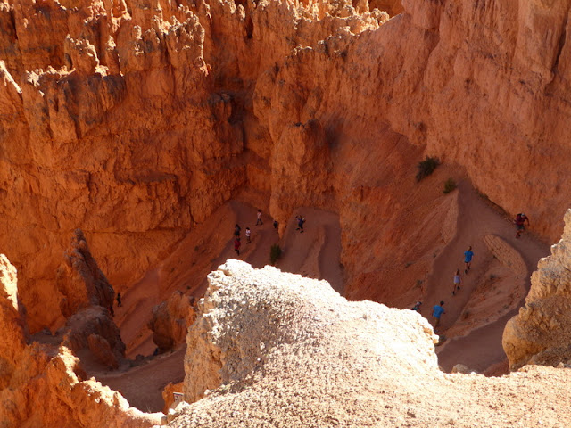
We were a little surprised to see so many hikers making their way down the trails into the canyon at such a late hour.  I imagine they are in better hiking condition than we are so it must have worked out fine for them.


Thor's Hammer

Gerry took this nice panorama of the view from Fairyland Canyon overlook.  It is hard to capture the beauty of the area and show how immense it is.  


We checked out the Tropic, UT area nearby and picked up some more geocaches and decided to call it a day.  By this time it was late and we were worn out from all the walking.  

If you haven't seen Bryce Canyon and the area, then you should put it on your "bucket list" to visit at least once.  We have been there 4-5 times and still enjoy seeing all the hoodoos and the beauty of the canyon.

We decided to extend another day at the campground and just take it easy and rest up.  I did manage to wash the car and remove the 100 lbs of dust from it, both inside and outside.  Other than that we just relaxed and enjoyed the nice weather.